Gwynedd.
Histoire
page en cours de construction ![]()
![]()
|
i
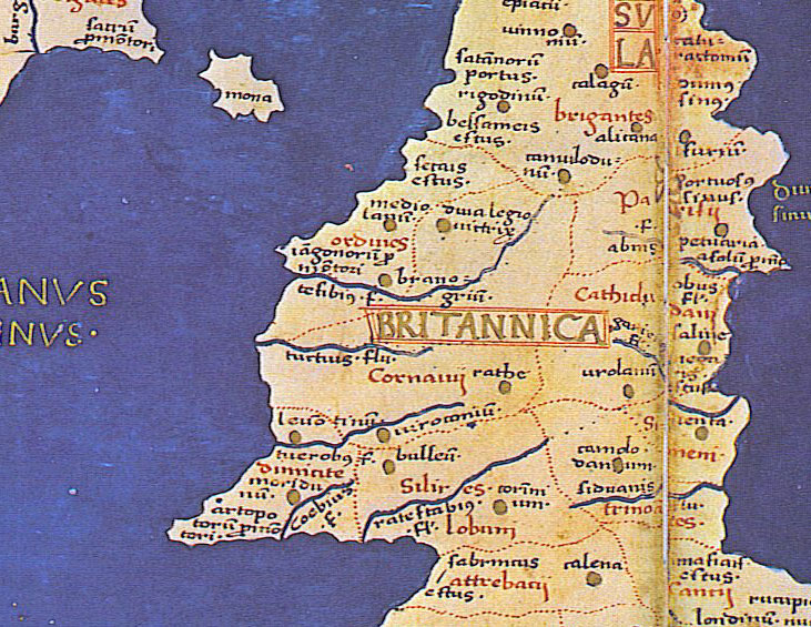
Extrait de la planche n° 2 du manuscrit de Naples (Orsamaggiore / Booking International) |
![]()
|
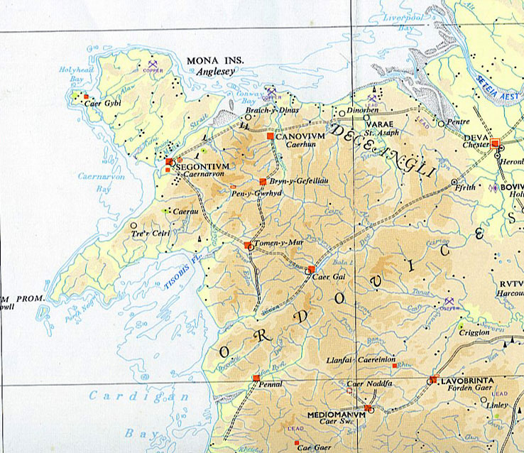
Extrait de Ordnance Survey : Map of Roman Britain. |
![]()
|
i
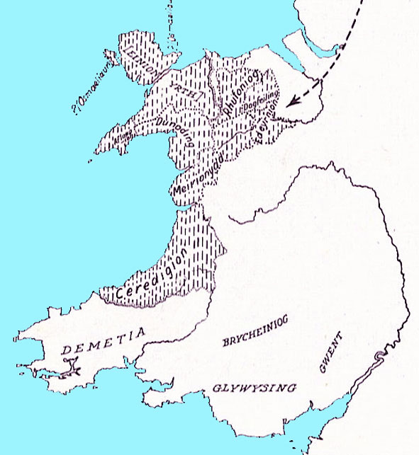
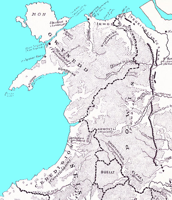
Carte extraite de William Rees : An Historical Atlas of Wales. Early Dynasties in Wales : The Cunedda Conquest (5th Century A.D) Les territoires portant les noms des fils de Cunedda sont représentés en hachuré. On peut y reconnaître : Osmaeliaun(< Osmael); Einion Yrth (< Einion); Rhufoniog (< Ruvon); Dogfeiling (< Dogmael); Dunoding (< Dunawd); Afloegion (< Afloeg); Meirioneydd (< Meirion); Ceredigion (< Caradog). |
![]()
|
i
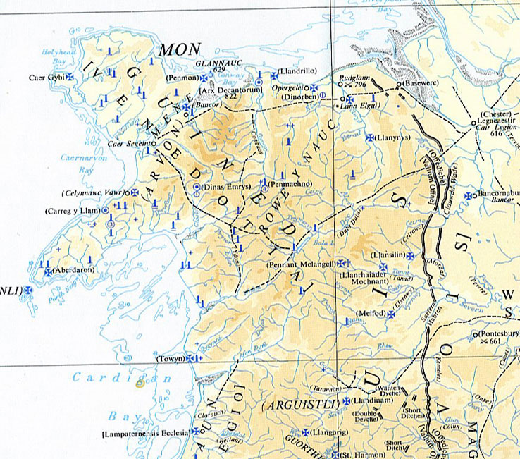
Extrait de Ordnance Survey : Britain in the Dark Ages. |
![]()
|
i
Carte extraite de William Rees : An Historical Atlas of Wales. Early Wales (7th and 8th centuries) |
![]()
|
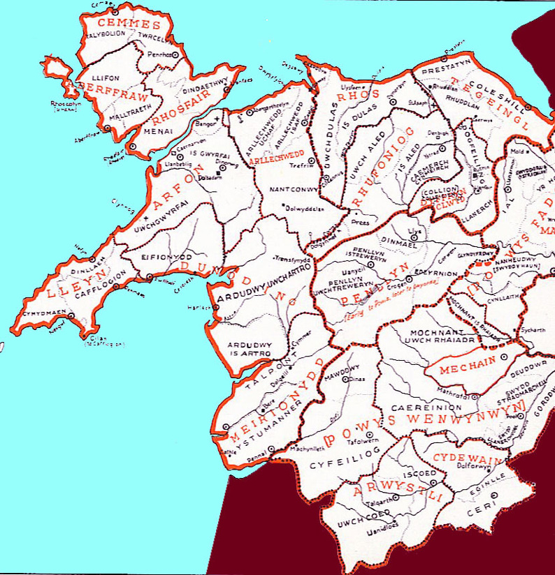
Carte extraite de William Rees : An Historical Atlas of Wales. Wales :Administrative Divisions : Gwledydd, Cantrefi and Cymydau Les divisions administratives du Pays de Galles (partie nord) : Régions, Cantrefs, Communautés. |
Divisions administratives du Gwynedd historique, y compris Meirionydd, Rhufoniog, Rhos, Tegeingl, Dyffryn Clwyd
| Cemmes | Talybolion; Twrcelyn; |
| Aberffraw | Llifon; Malltraeth |
| Rhosfair | Menai; Dindaethwy |
| Lleyn | Cymydmaen; Dinllaeh; Cafflogion |
| Arfon | Uwch Gwyrfai; Is Gwyrfai |
| Dunoding | Eifionydd; Ardudwy Uwch Artro; Ardudwy Is Artro |
| Meirionydd | Talpont; Ystumanner |
| Arllechwedd | Arllechwedd Uchaf; Arllechwedd Isaf; Nantconwy |
| Rhos | Uwch Dulas; Is Dulas |
| Rhufoniog | Uwch Aled; Is Aled; Caemerch (Cynmeirch); Prees; Dolgynval |
| Tegeingl | Prestatyn; Coleshill; Rhuddlan |
| Dyffryn Clywd | Dogfeiling; Collion (Colleigion); Llanerch |
![]()